
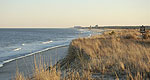


Transportation information for Rehoboth Beach is provided below. Travel information includes driving directions, maps, airport information and more.
Transportation Services
Access Ride
- Lewes
- Transportation Services
- 302-645-1400
Map + Directions
Basic Directions
The nearest major airport is the Philadelphia International Airport located 110 miles north in Philadelphia. The Philadelphia International Airport is one of the larger airports in the nation. Thirty airlines provide 700 daily non-stop flights to more than 120 destinations including approximately 30 international destinations. The airport serves more than 30 million passengers per year. An alternate is the Baltimore-Washington International Airport located approximately 115 miles northwest just south of Baltimore, MD. The airport is serviced by many major airlines providing 331 daily non-stop flights and 11 International non-stop flights daily. Some of the airlines that fly into BWI are United Airlines, Southwest Airlines, Delta Air Lines, American Airlines, and more.

